Due to the positioning of tectonic plates, ports are exposed to a significant geographical risk distribution (figure 29). As container ports have a life span of at least 50 years, it is almost certain that all container ports will be exposed to an earthquake event. What will differ is the intensity of this event. Some areas face a high risk of a high-intensity earthquakes will occur over a period of half a century, while in others only a low-intensity earthquake can be expected over the same period. Ports bordering the Pacific Plate, also known as the "Pacific Ring of Fire", are at a particularly high risk as most of the largest earthquake events of the last century took place in that region.
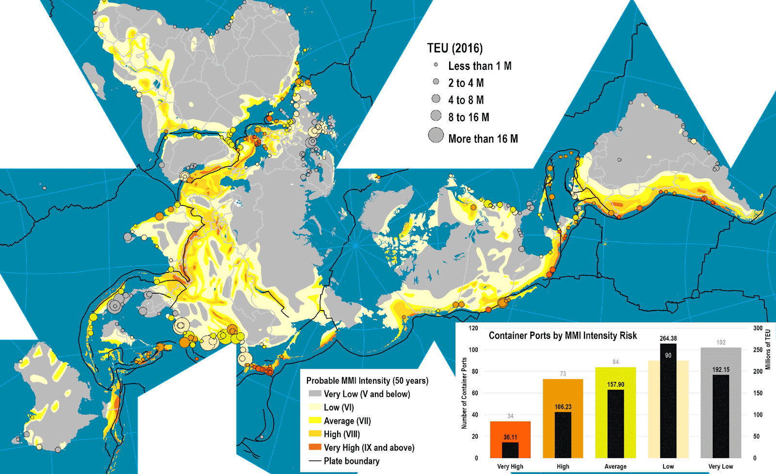
Areas of high tectonic risk are associated with lower economic and port activity levels. For instance, 34 container ports (19 per cent of all ports) in very high MMI (Modified Mercalli intensity scale) risk areas (IX scale and above) account for only 4.7 per cent of the total TEU handled. Japan and the Pacific Coast of the Americas are areas of high risk. Other areas of high port activity have a very low risk, such as around Australia, the Baltic and northern Europe, the American Eastern Seaboard, the Gulf Coast, and the Straits of Malacca. Ports in these areas are almost certain to experience a notable earthquake event that could potentially damage their infrastructure and superstructure.
Even if a port may not be in a high-risk area, or not directly impacted by a specific earthquake event, tsunamis may cause alerts and interruptions in operations.
Figure 29: Risk of earthquakes for global container ports